Type Localities
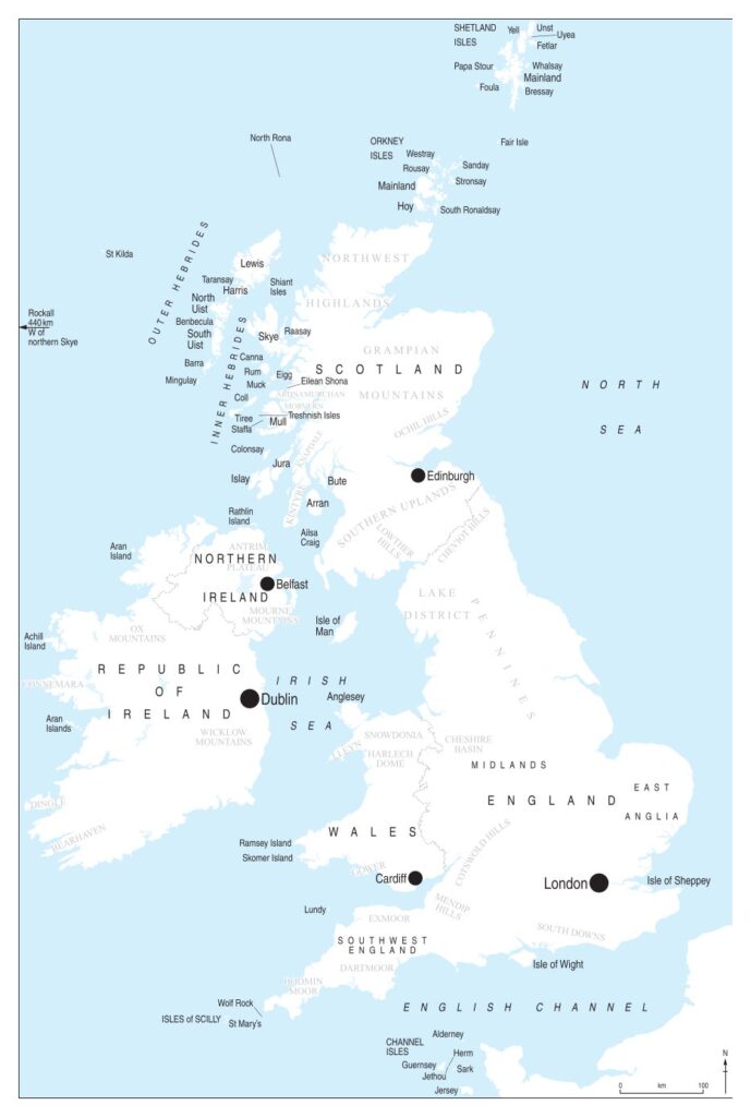
Maps are not included in MBI 2009–2024. Clicking the map on the left gives access to revised maps derived from MBI 2008 on which the new type localities have been added (courtesy of Liverpool University Press). In addition, the maps show the most important mineral localities and main mineral orefields. These maps can be downloaded if required.
Blank for spacing
Corrigendum
It is inevitable that in a book of this size, a few errors will have crept in. Those that have been identified are included in the corrigendum here.
Blank for spacing
3D Images
We are indebted to John Chapman for providing many exquisite 3 Dimensional images of the specimens illustrated in the book. These can be found in the files below. Get your red-cyan glasses ready.